Exploring Historical Landscapes: The Role of LiDAR, Historical Mapping, Aerial Surveying, and Field Surveying in Identifying Coal Fields
Understanding historical landscapes is crucial for preserving cultural heritage, studying environmental changes, and uncovering the stories of past human activity. Among these landscapes, coal fields stand out as significant markers of industrial history, reflecting the economic and social transformations of regions around the world. Modern technologies and traditional methods combine to offer powerful tools for identifying and analyzing these historical sites. In this blog post, we delve into the use of LiDAR, historical mapping, aerial surveying, and field surveying to uncover and study coal fields.
Light Detection and Ranging (LiDAR) technology has revolutionized landscape archaeology and historical studies. By emitting laser pulses from an aircraft and measuring their return times, LiDAR generates highly detailed, three-dimensional maps of the earth’s surface. This is particularly useful for identifying subtle topographical features that indicate former mining activities, such as spoil heaps, collapsed shafts, and tramways, which may be obscured by vegetation or urban development
In coal field identification, LiDAR can reveal the micro-relief of the terrain, helping researchers detect the remnants of mining infrastructure even in heavily forested areas. The precision of LiDAR data enables the creation of detailed digital elevation models (DEMs), allowing for in-depth analysis of landscape modifications related to coal extraction.
Historical maps are invaluable for understanding how landscapes have evolved over time. Old mining maps, land surveys, and industrial plans provide direct evidence of coal field locations, mine boundaries, and infrastructure such as railways and canals used for coal transport.
By comparing historical maps with contemporary data, researchers can track changes in land use, identify areas where mining has altered the landscape, and locate sites that may no longer be visible on the ground. Digital archives and Geographic Information Systems (GIS) facilitate the integration of historical maps with modern spatial data, enhancing the accuracy and efficiency of coal field identification.
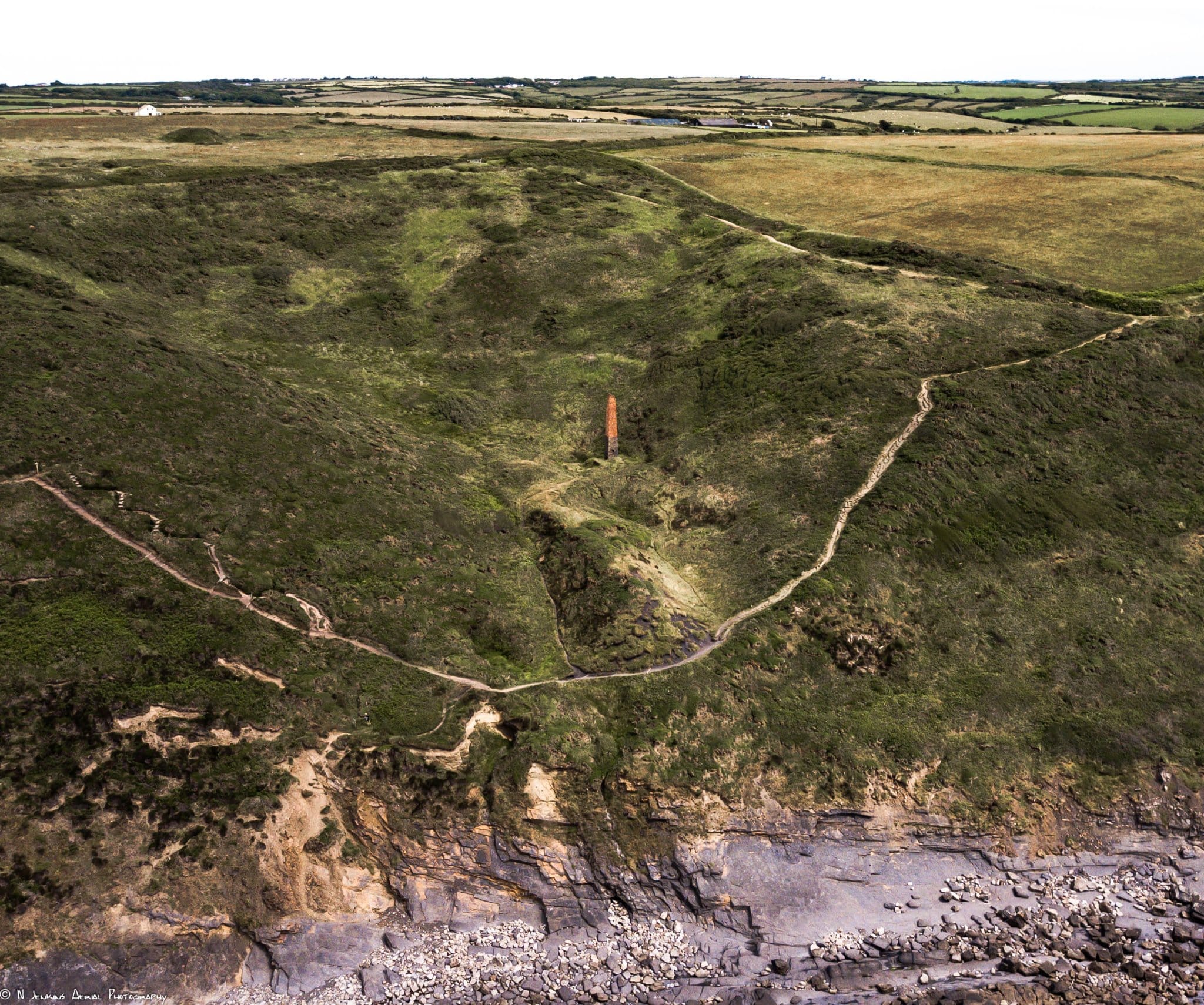
Aerial surveying involves capturing photographs or multispectral images from aircraft or drones, offering a broad overview of large areas. Historical aerial photographs, sometimes dating back to the early 20th century, provide snapshots of coal field landscapes during different stages of industrial activity.
Modern aerial surveys equipped with high-resolution cameras or sensors can detect variations in soil composition, vegetation health, and moisture levels—indicators often linked to underlying mining features. Infrared and thermal imaging can highlight subsurface disturbances or earthworks, contributing to a more comprehensive understanding of coal field sites.
While remote sensing and mapping technologies are powerful, field surveying remains essential for validating findings and gaining detailed insights. Archaeologists and historians conduct on-the-ground investigations to examine physical evidence such as mine entrances, machinery remains, and worker settlements.
Field surveys often involve recording GPS coordinates, photographing features, and collecting samples for further analysis. This hands-on approach ensures that interpretations based on remote data are accurate and provides context that cannot be captured remotely, such as oral histories or material culture artifacts.
The most effective studies of historical coal fields integrate LiDAR, historical mapping, aerial surveying, and field surveying to create a multi-layered understanding of these landscapes. LiDAR and aerial data provide initial detection and mapping, historical documents offer contextual information, and fieldwork confirms and enriches interpretations.
This interdisciplinary approach not only aids in documenting and preserving coal mining heritage but also informs land management, conservation efforts, and educational initiatives. By employing these technologies and methods together, researchers can unlock the stories embedded in historical landscapes and ensure they remain accessible for future generations.
The identification and study of historical coal fields benefit immensely from the synergy of advanced technologies and traditional survey methods. LiDAR’s ability to penetrate vegetation and reveal subtle terrain features, combined with the rich data from historical maps and aerial imagery, provides a comprehensive toolkit for researchers. Coupled with meticulous field surveying, these approaches enable a deeper appreciation and understanding of the industrial past, contributing to heritage preservation and historical scholarship.
As technology continues to evolve, so too will our capacity to explore and interpret the hidden facets of historical landscapes, ensuring that the legacy of coal fields and other industrial sites remains an integral part of our cultural narrative.